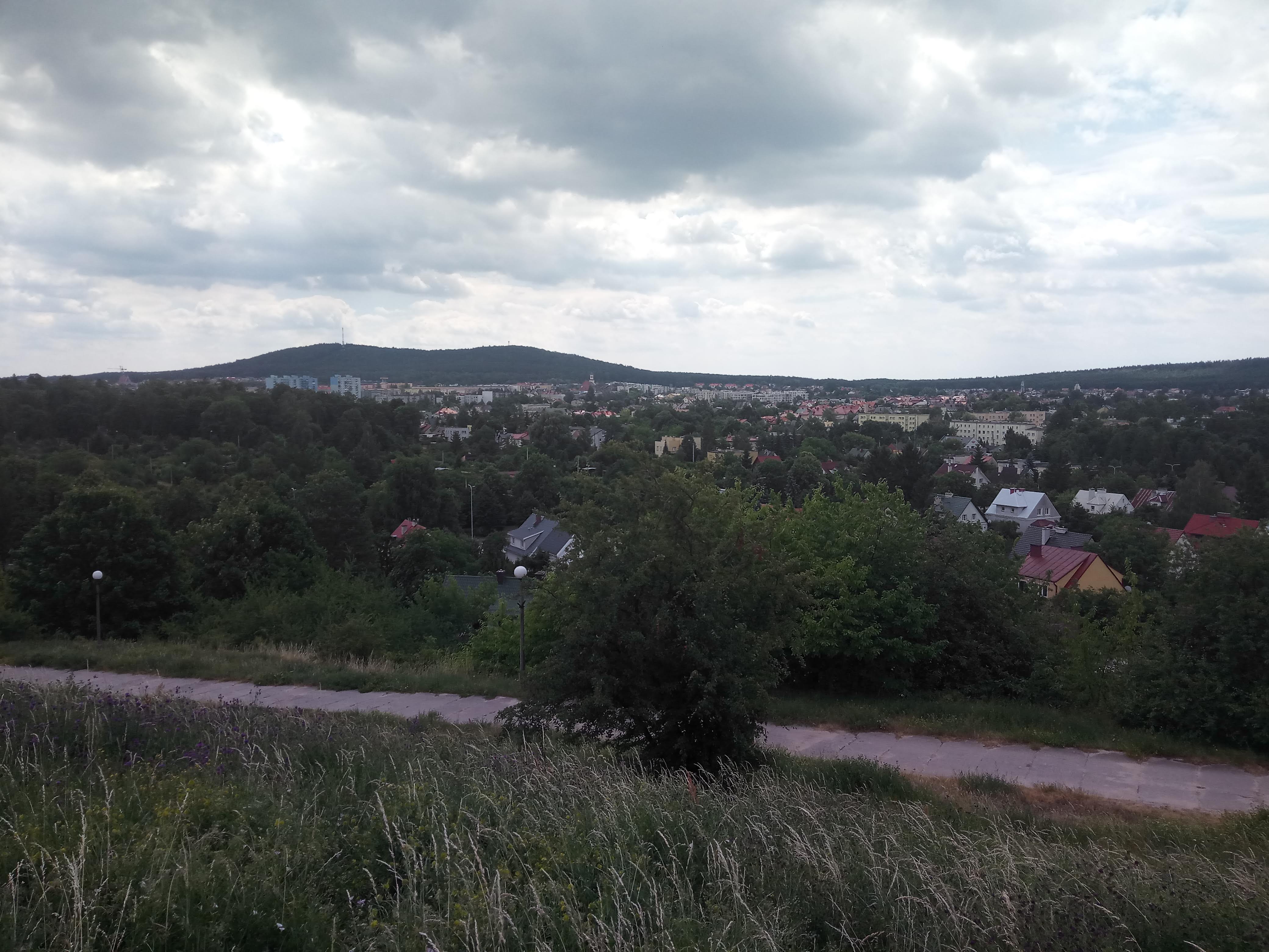
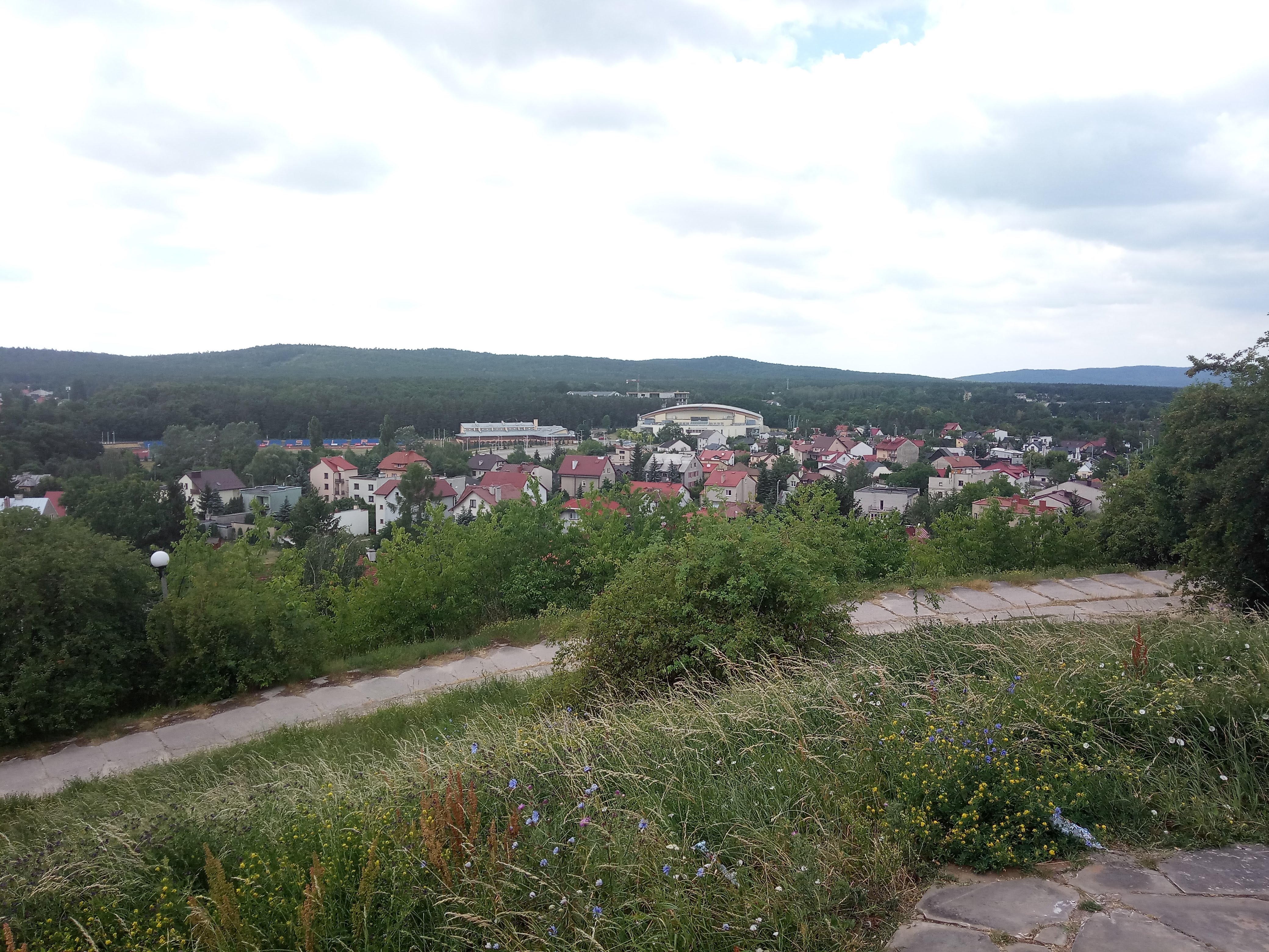
Kielce is situated at an approximate distance of 180 km form Warsaw situated in the heart of Świętokrzyskie Mountains (Holy Cross Mountains). It is an excellent location for a day trip or a weekend getaway. Being located in a geographically unique location, Kielce has one of the best landscape in Poland.
This time I did day trip and FlixBus was the faster, cheaper and convenient option compared to PKP for traveling to Kielce from Warsaw. The city has good public transportation with day tickets. There is an ZTM center near the long distance bus stop making it more convenient to get a day ticket. Kielce has an excellent tourist information center which provide maps and information booklets and is the best place to start the trip.
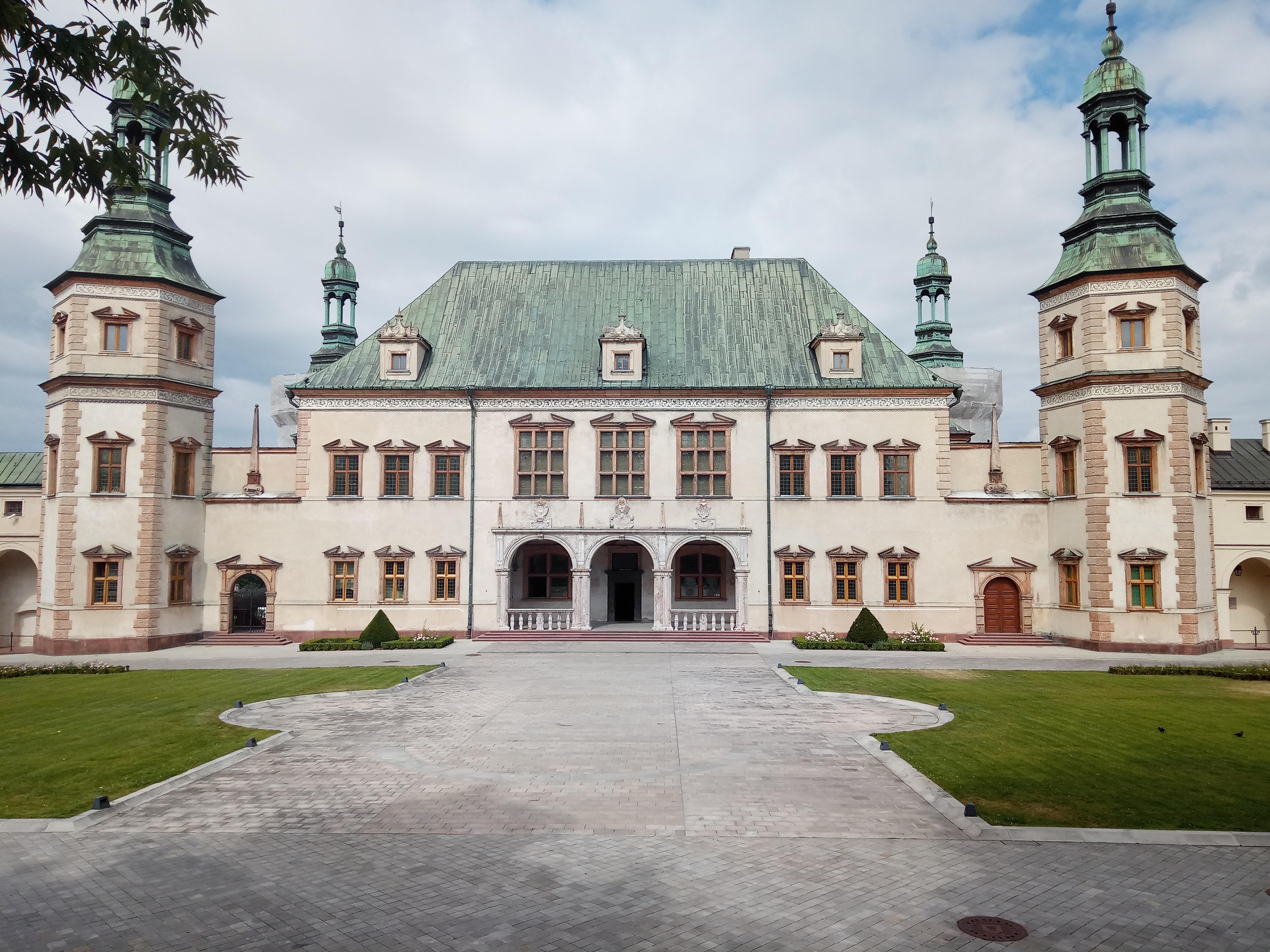
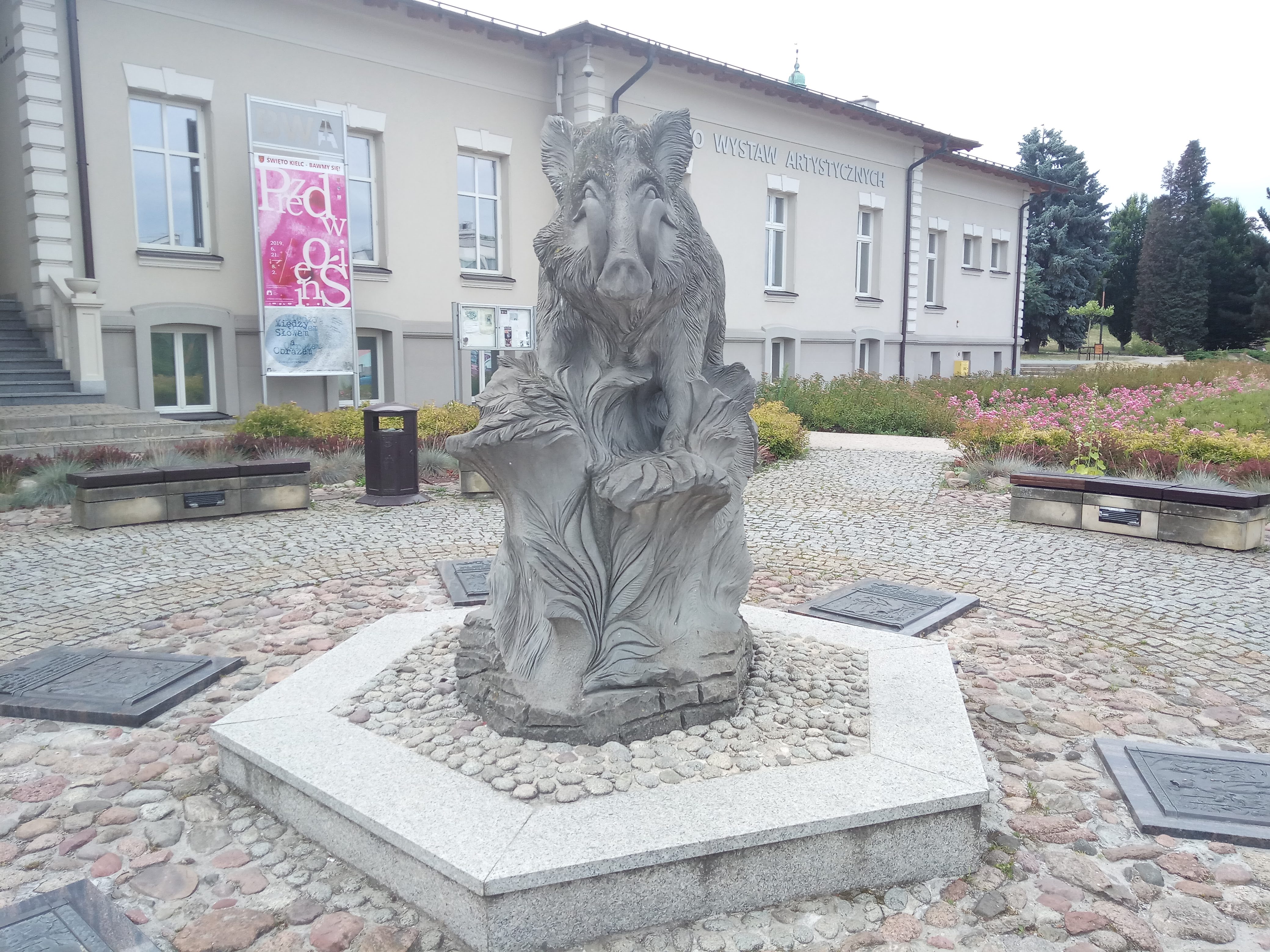
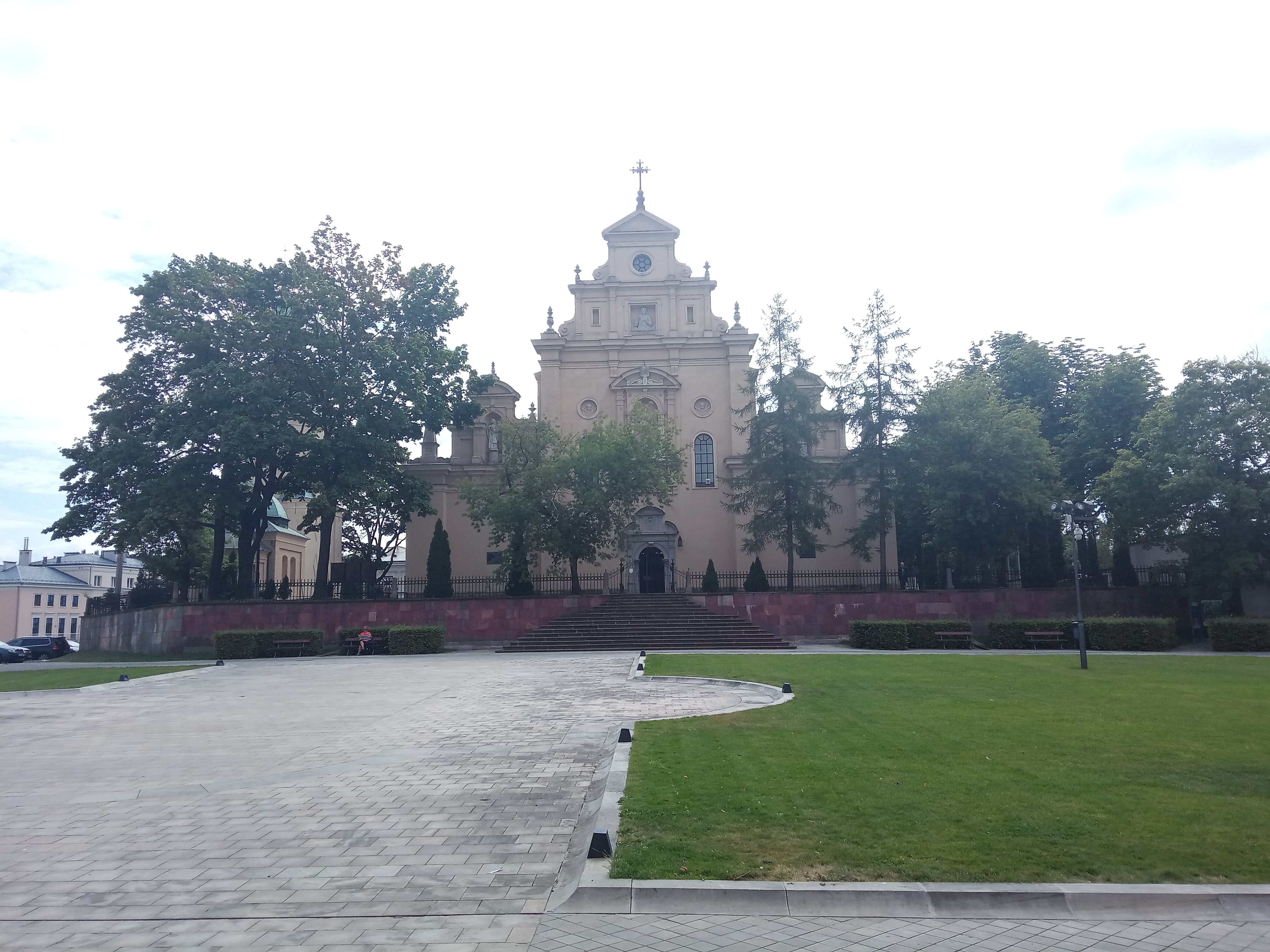
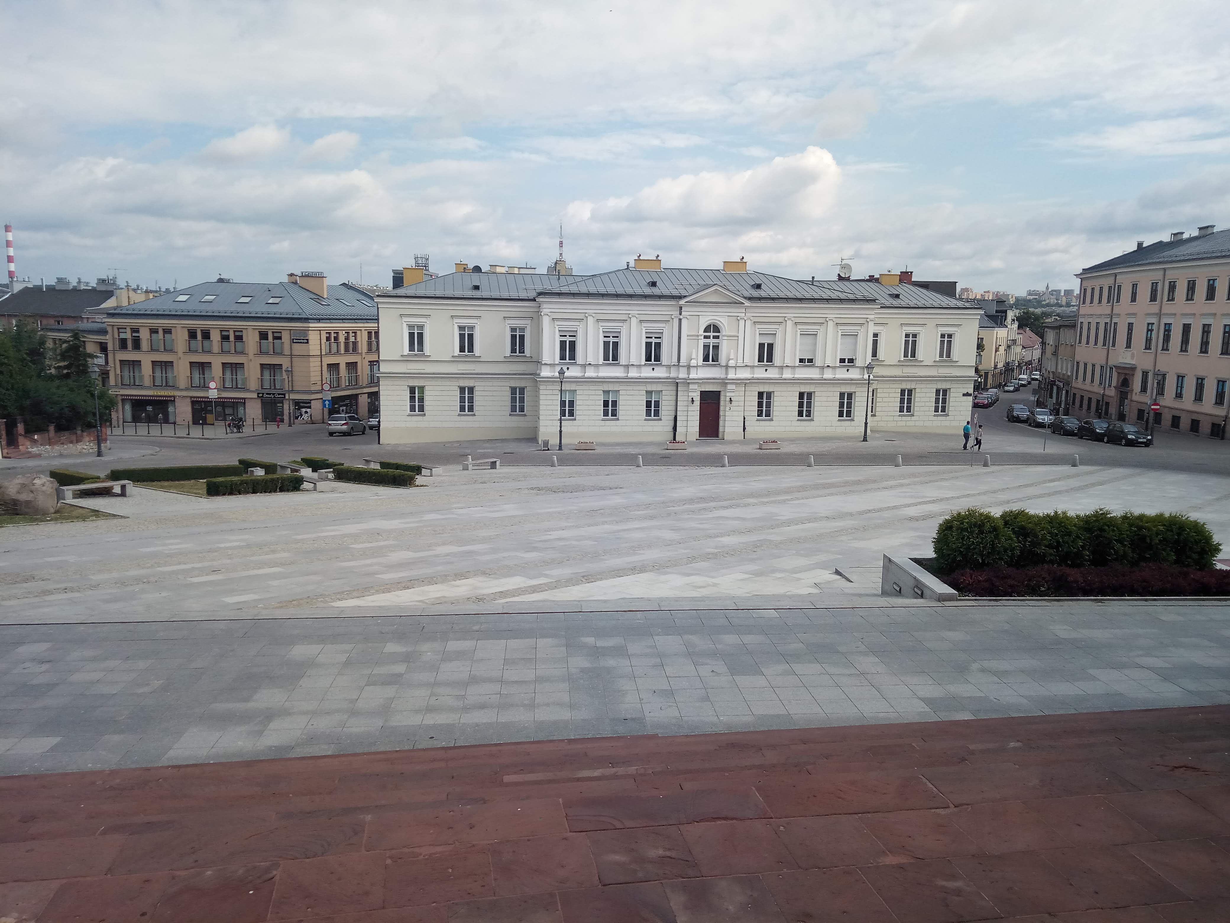
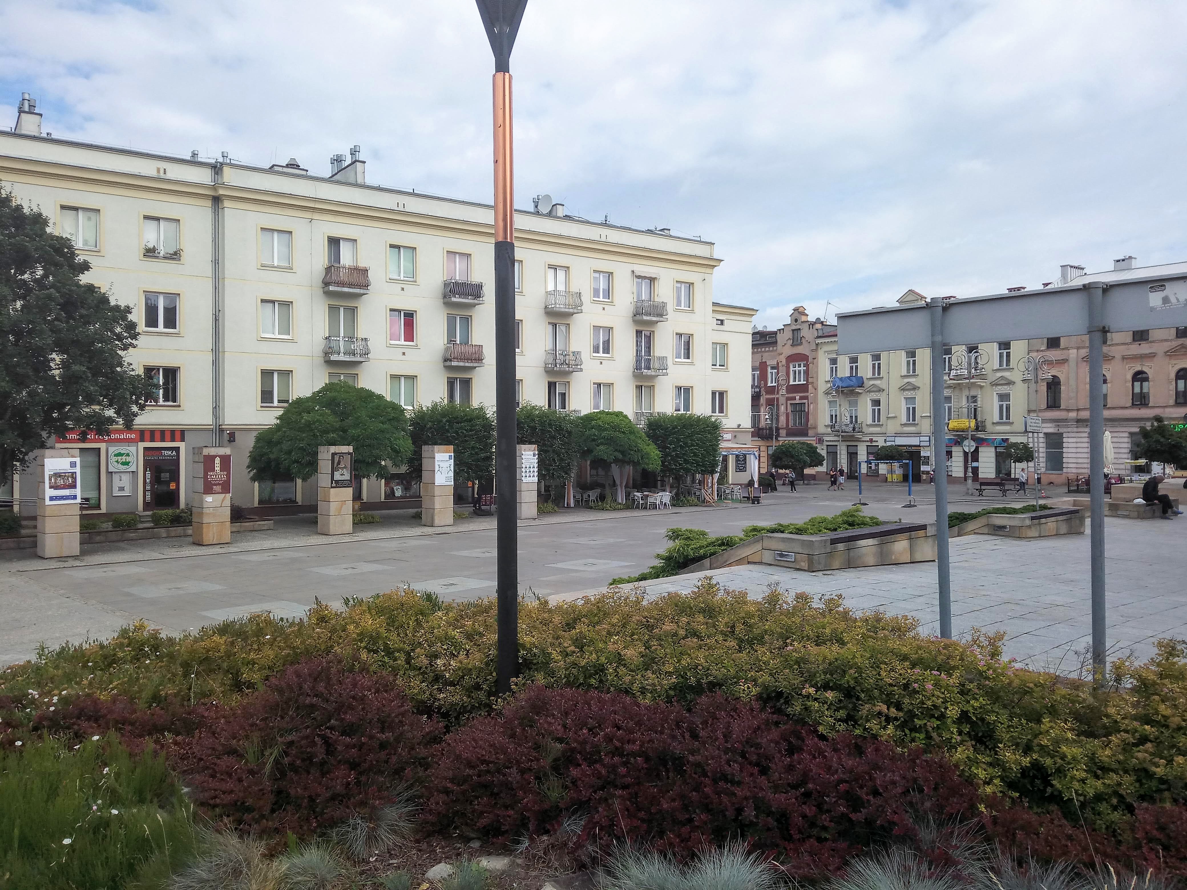
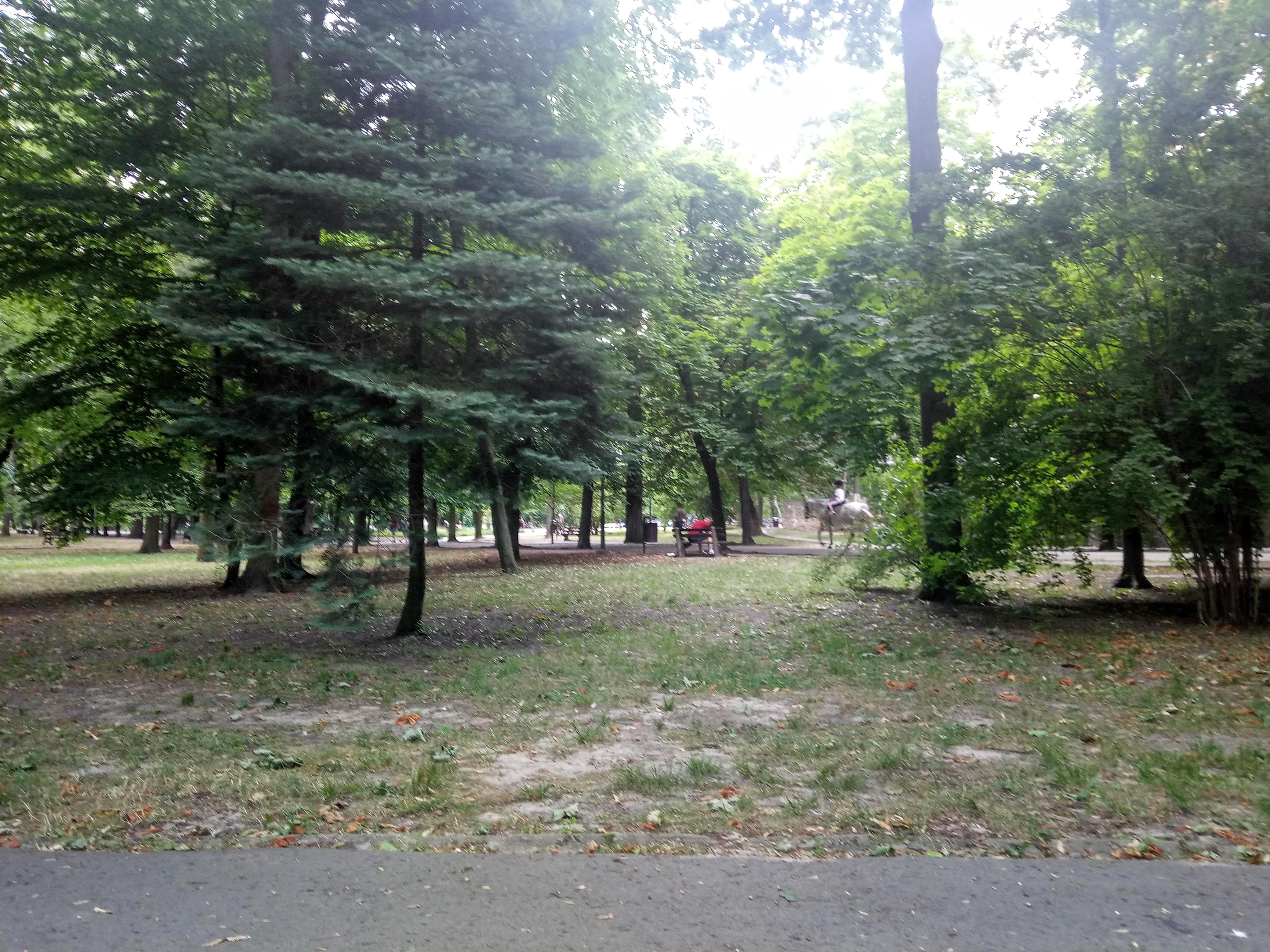
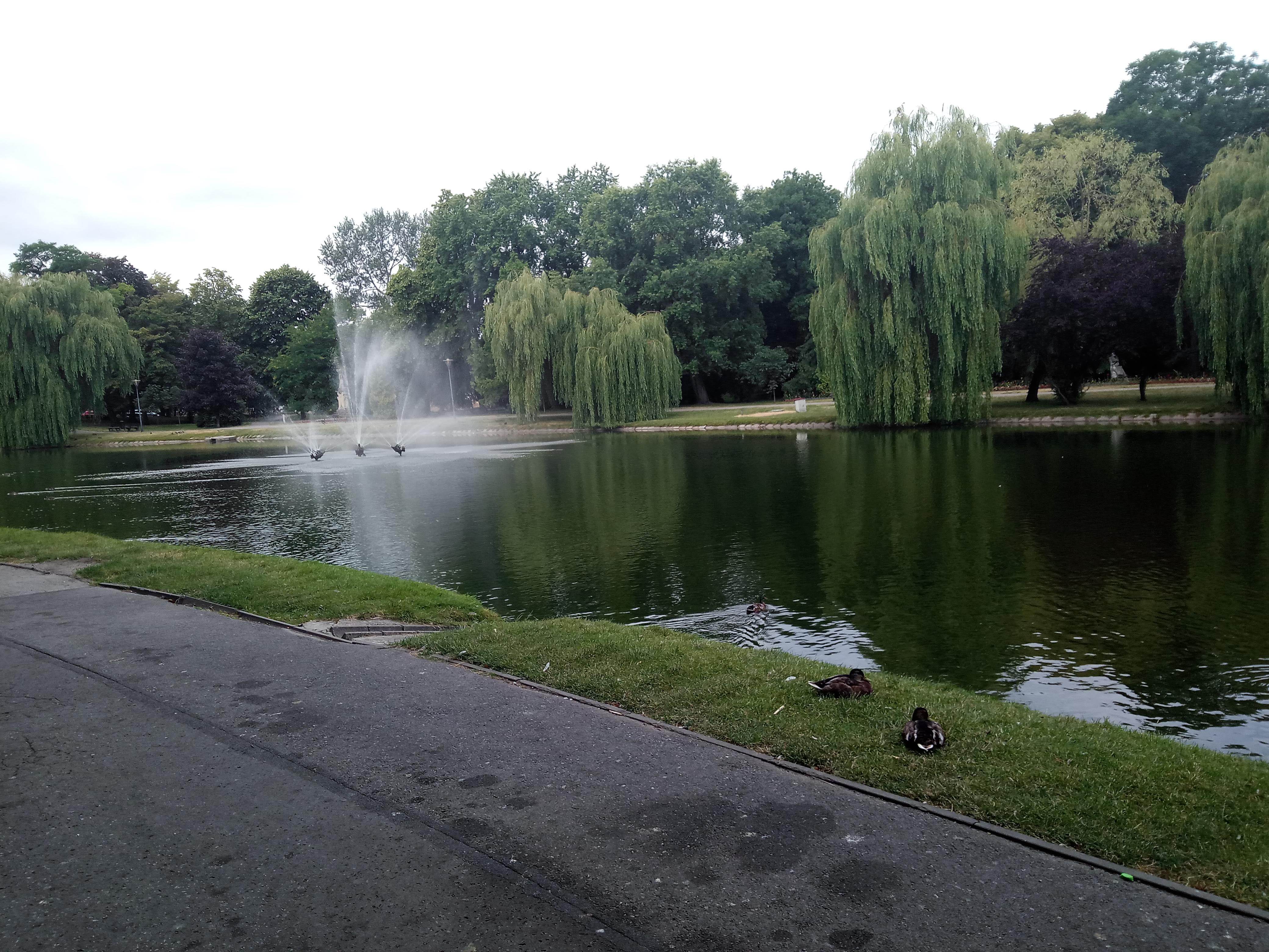
The tourist information center is at the artist square. The artist square is located at the meeting point of Henryk Sienkiewicz Stree (ulica Henryka Sienkiewicza) and Kapitulna street (ul. Kapitulna). The artist square is a major exhibition center for art -paintings and sculptures. The monument of wild boar called Kiełk here is connected to the legend about the creation of the city. According to the legend, he region of Kielce city was thick forest 900 years ago and Prince Mieszko came for hunting in the forest, got separated from his companions, and was lost. The prince decided to spend the night in the wilderness and had a dream about being attacked by brigants and was saved by Saint Adalbert. The saint created a stream for the prince in his dreams, which he found nearby after waking up. While returning he noticed the wild tusk of an unknown animal, probably a boar. The St Adalbert’s Church was erected and the stream was called Silnica (‘Strong Water’). The city was named as Kielce after the mysterious tusks (‘kieł’ in Polish). The Palace of Krakow Bishops, the Tomasz Zieliński Palace and the Stanislaw Staszic City Park are other major attractions.

There are five nature reserves in Kielce – four of which are of rocky-geological type: Kadzielnia, Ślichowice, Białogon and Wietrznia and one of forest type: Karczówka. For someone who is interested in understanding geography and palenthology, the region is a treasure trove of secrets and knowledge.
Kadzielnia natural reserve
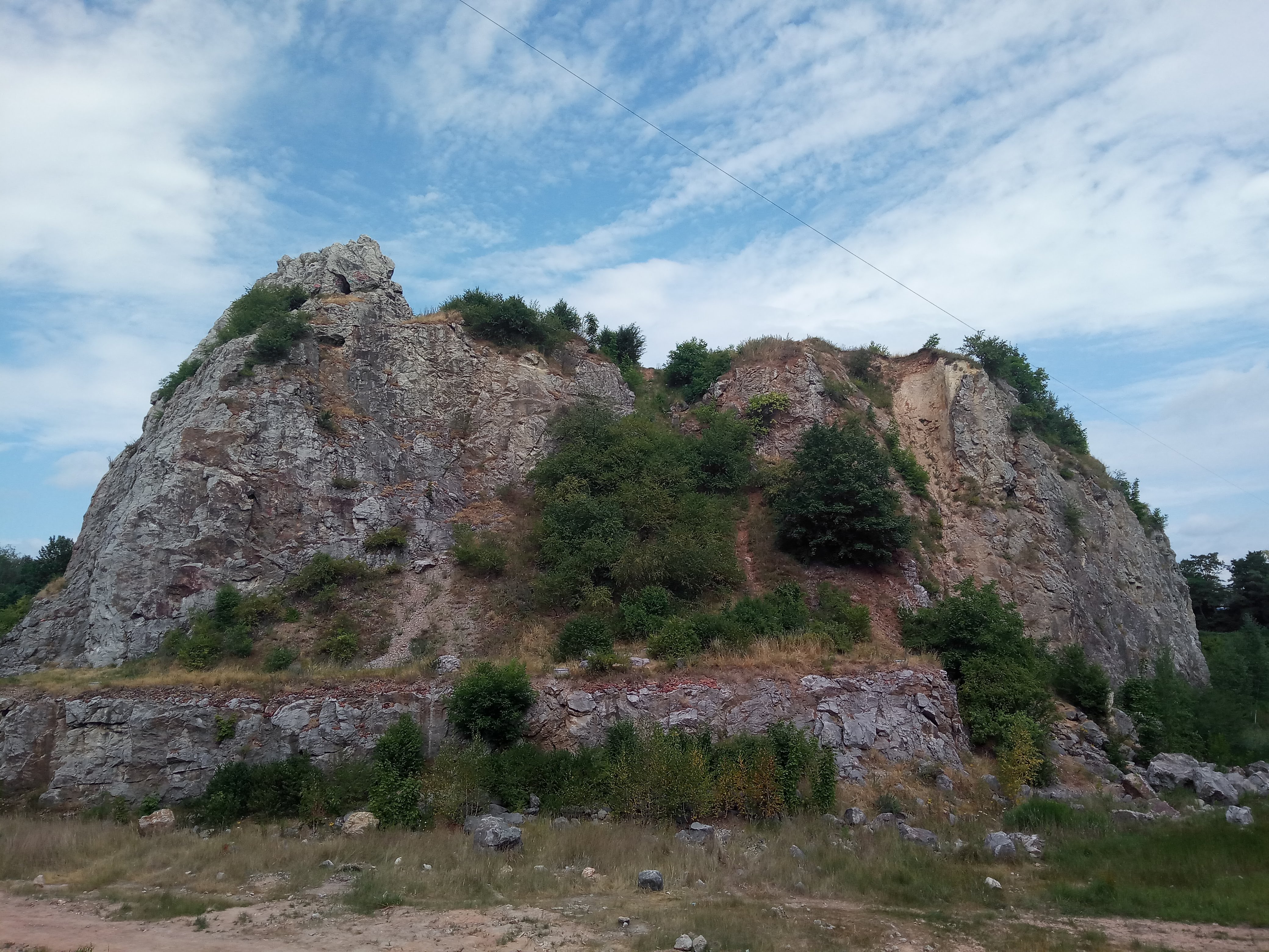
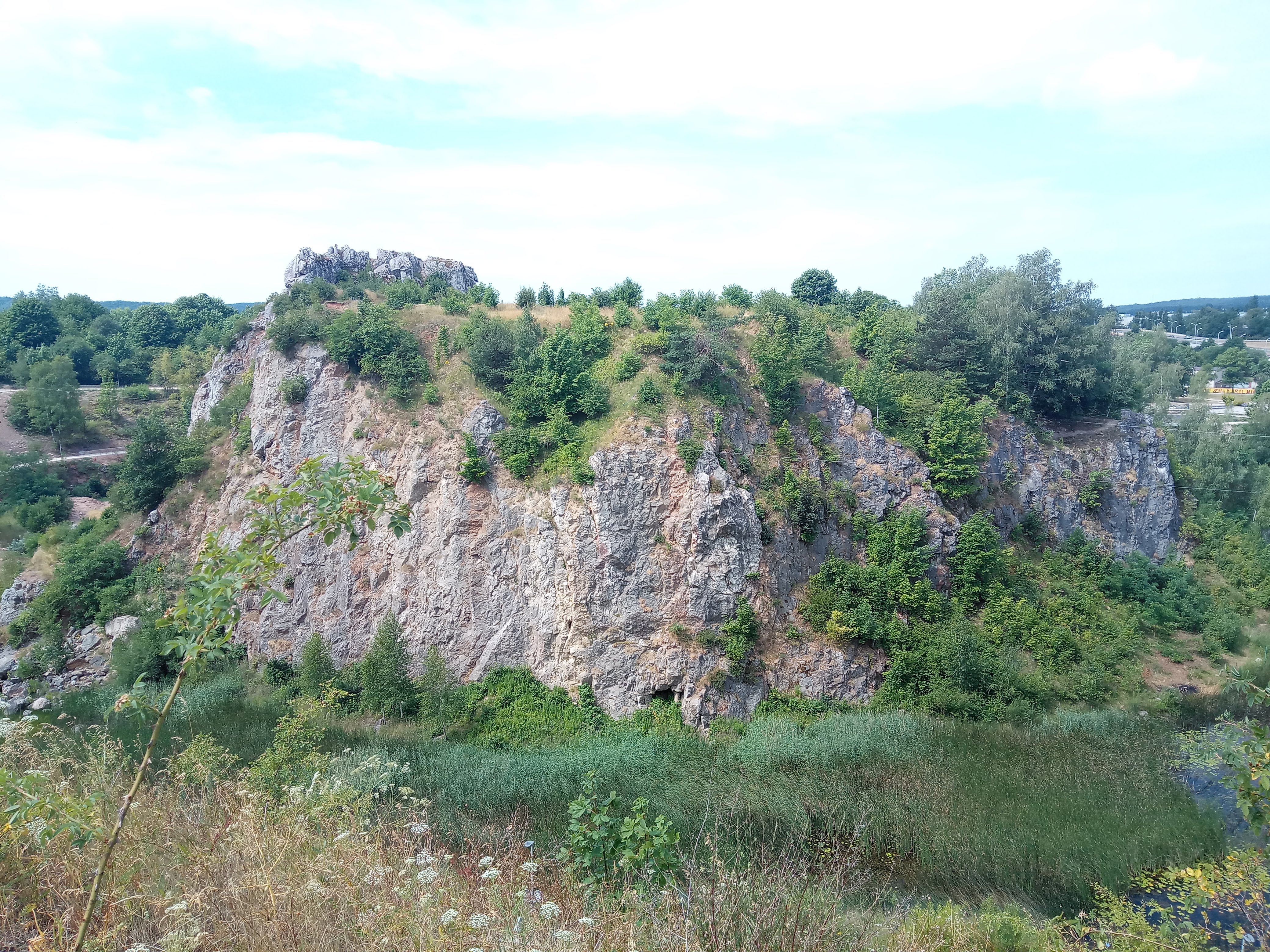
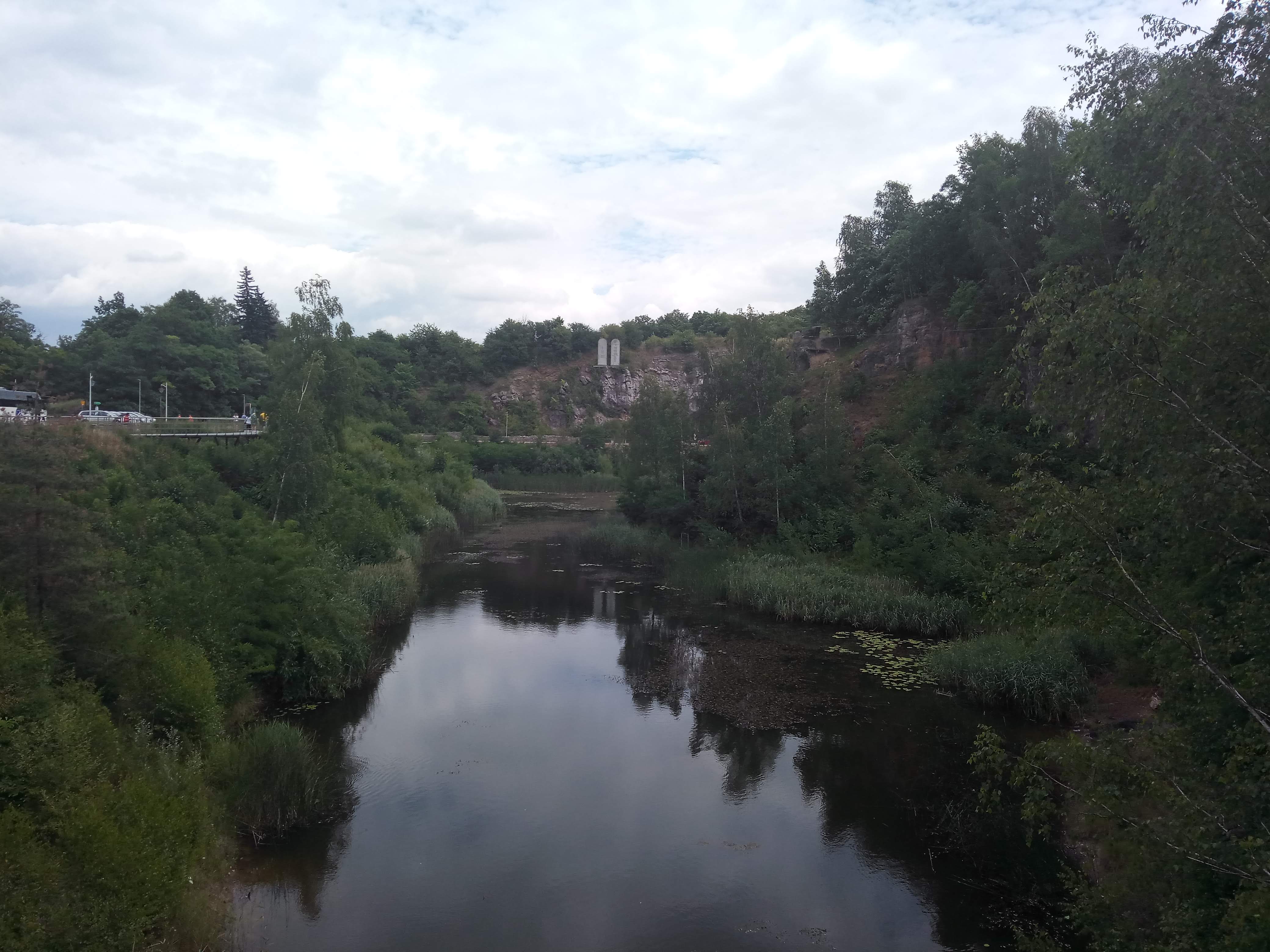
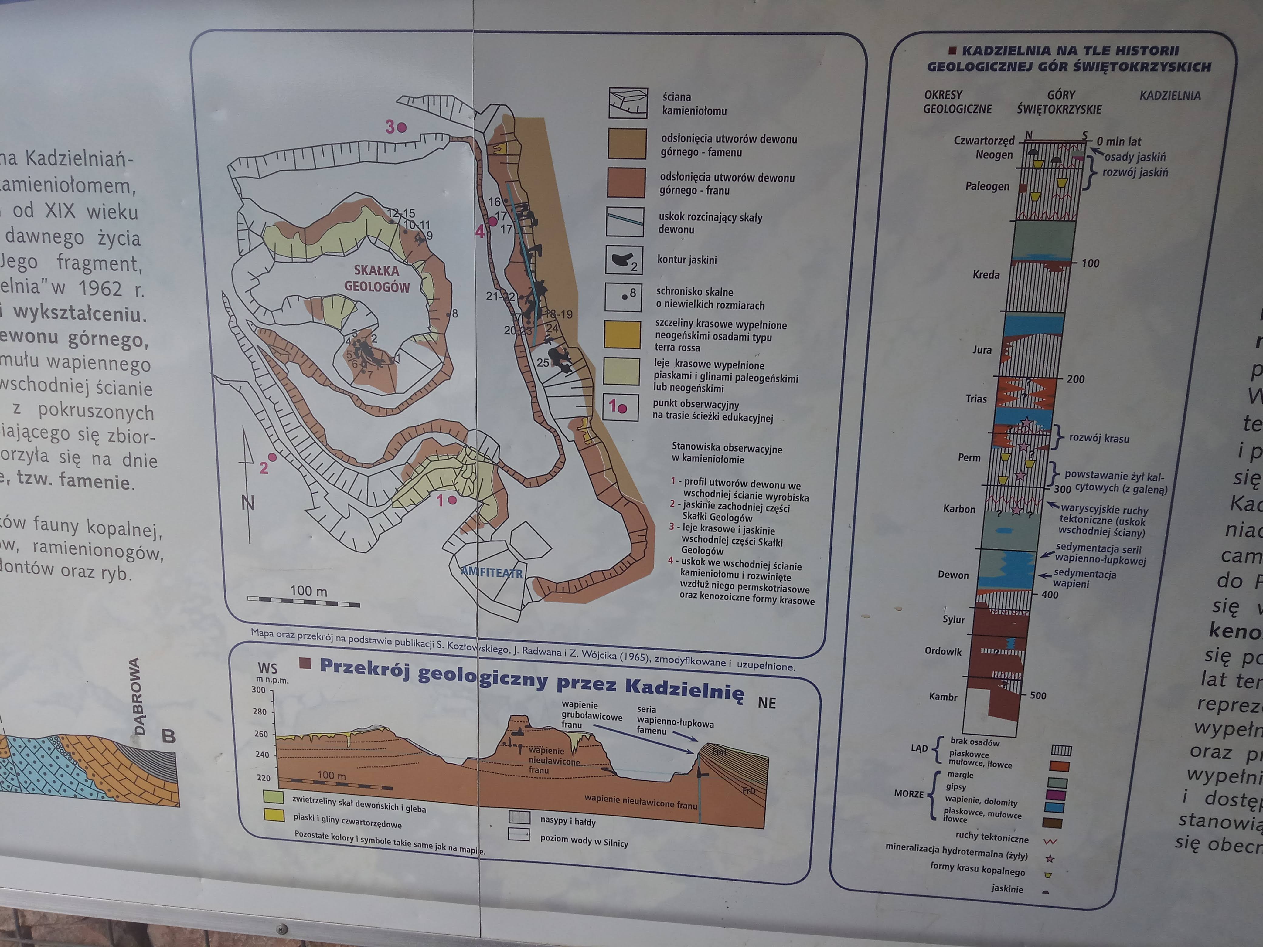
I visited the Kadzielnia natural reserve which includes the Kadzielnia Mountain which is at a height of 295 m above the mean sea level. This mountain belongs to the Kadzielnia Range located in the southern and western part of Kielce. The limestones formed in Kadzielnia have been mined since the 18th century. After the quarry ceased operations in 1962, Kadzielnia was developed for recreational and tourist purposes.

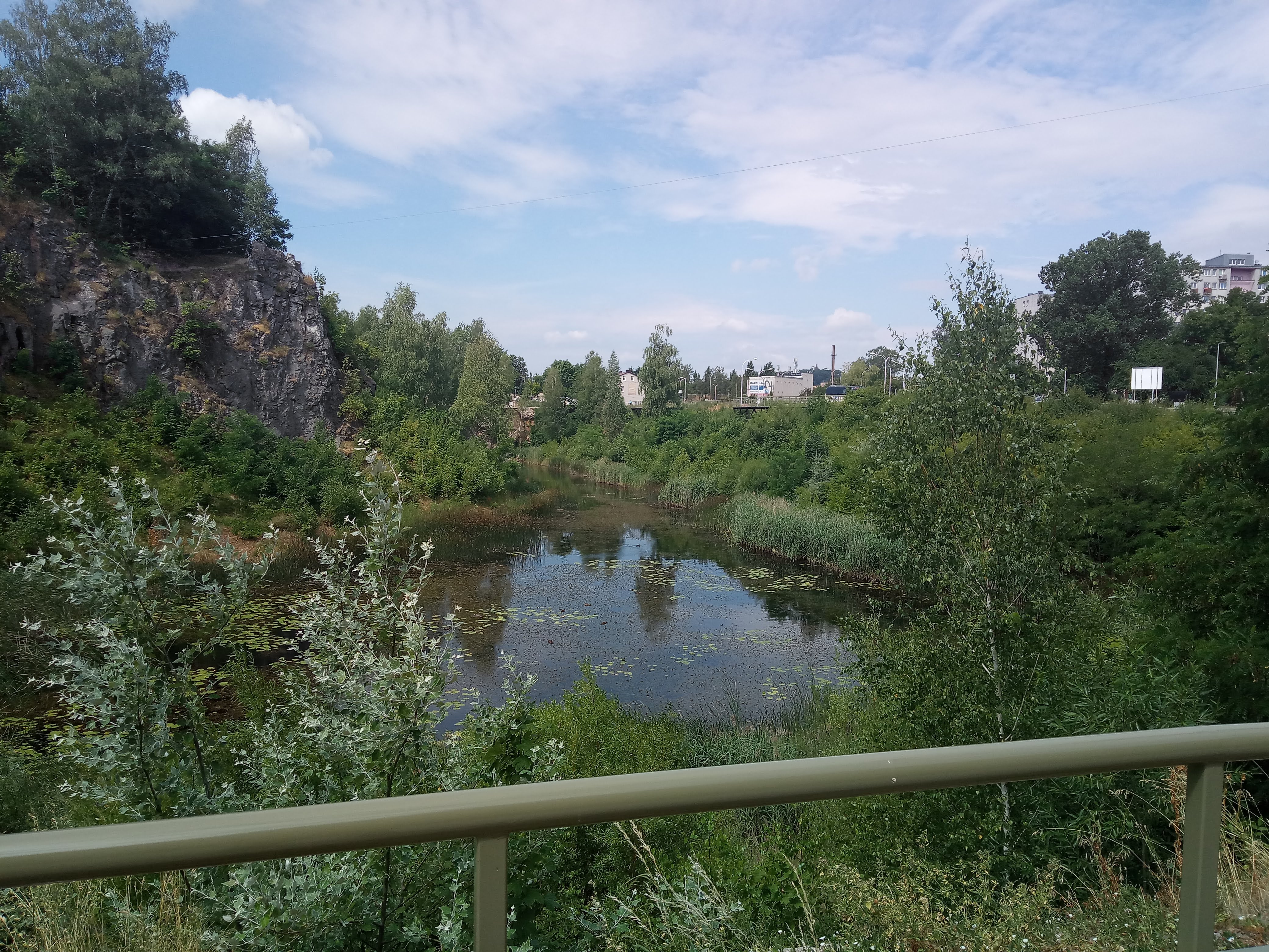
“Kadzielnia, as a place associated with the former excavation of Devonian limestone had several unusual episodes in its post-mining history. In the 1960s, when mining and drainage of the excavation were completed, groundwater from the Devonian aquifer filled the bottom of the quarry, creating so-called Emerald Lake. At the turn of the 1960s and 1970s, as a result of increased water intake from municipal intakes, “Kielce-Bialogon”, “Wojska Polskiego” and the intake of the former “Iskra” rolling bearings plant, the ground water level decreased , which led to the disappearance of the Emerald Lake. The reactivation of the lake coincided with the construction of the Kadzielnia Amphitheater in 1971, when the decision of the local authorities started flooding the excavation with water from the intake of Kielce Bialogon. The escape of water through numerous tectonic and carst cracks as well as the cessation of water supply from the aforementioned approach resulting from the water deficit in the city meant that the Emerald Lake could not be maintained until the 1980s and eventually ceased to exist.”
“Over the years, in the north-western part of the quarry, from the side of Krakowska Street, a small lake was formed, which was maintained on clay loam, filling the bottom of the quarry and acting as a “sealer”. Due to the supply of rainwater and water from surface and subsurface runoffs (including water infiltrating from the Silnica River), the chemical composition properties and, in particular, the colour of the water differ significantly from that which filled the Szmaragdowe Lake. Today’s lake in Kadzielnia, changing its surface depending on the seasons and powered from completely different sources, has nothing to do with the former emerald water. Regardless of this, the water still forms the decoration of Kadzielnia and diversifies the raw rock landscape of the former quarry.”


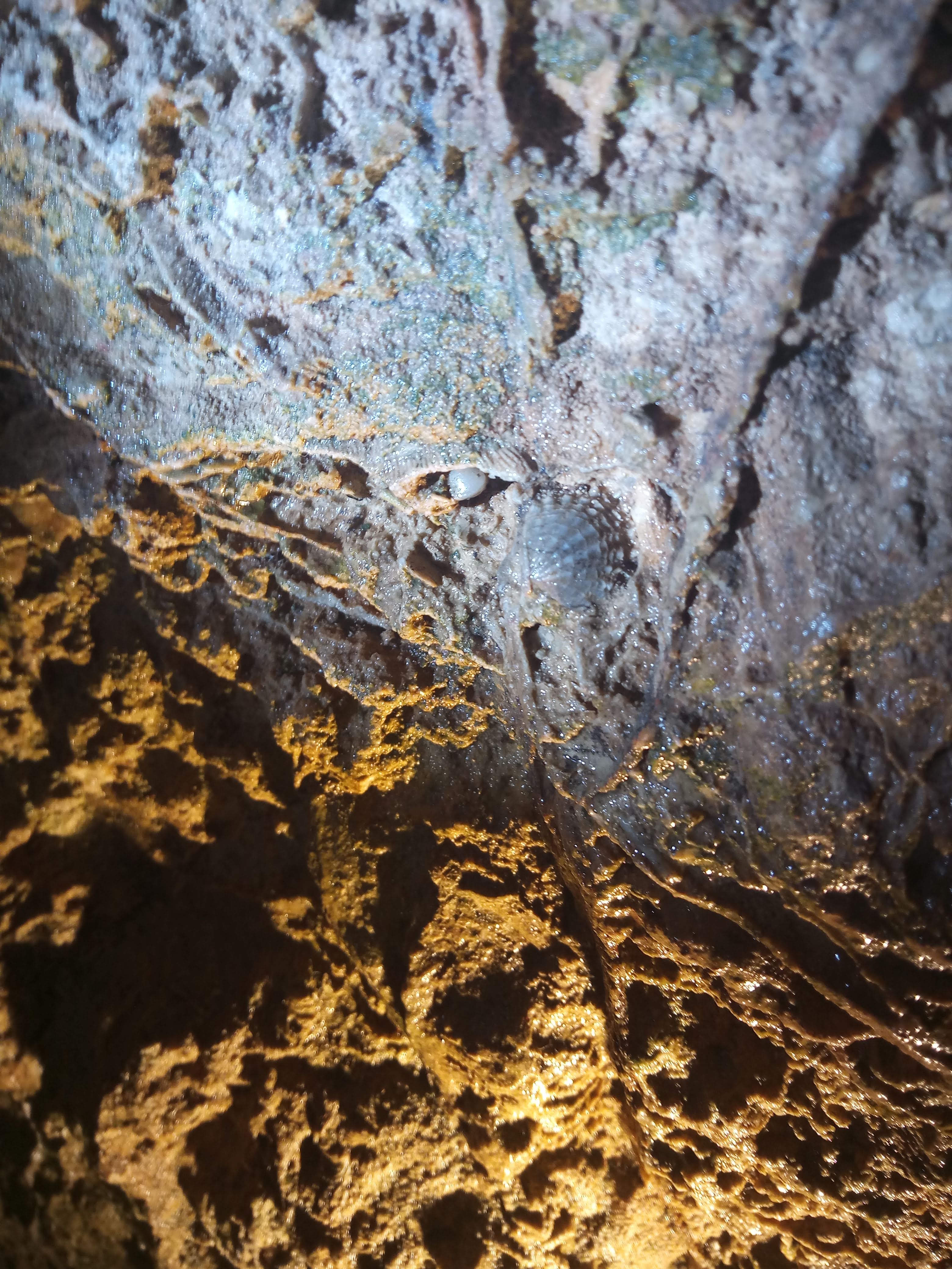
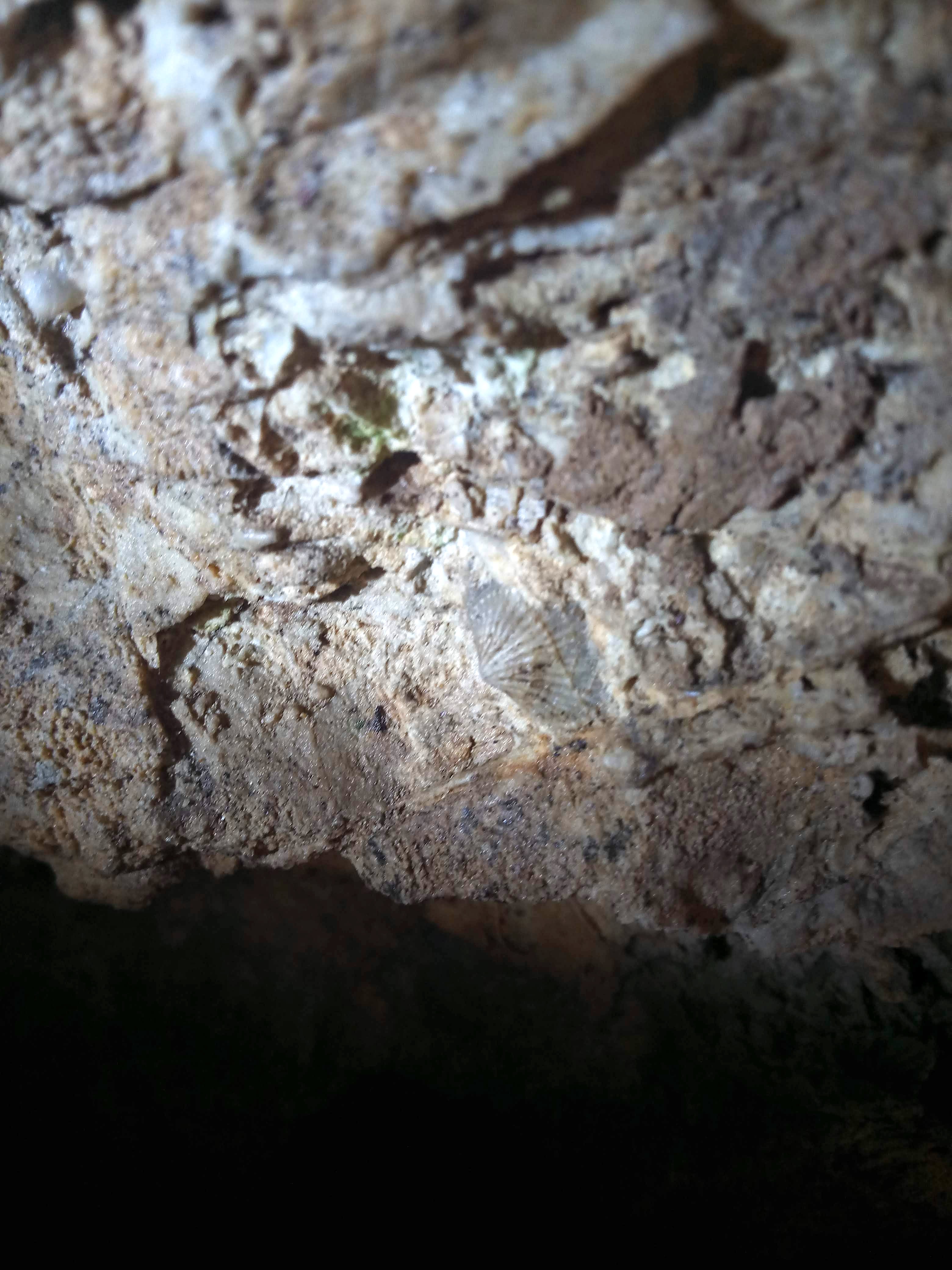
“The sequence of the Upper Devonian carbonate rocks are outcropped in the abandoned quarry. The Frasnian massive, biohermal limestones are overlain by the Fammenian limestone-marl series bearing numerous groups of fossils: invertebrates and fishes (new taxa). In the limestones hydrothermal veins of calcite and calcite-barite-galena mineralisation occur. The extensive karstification during the Cenozoic produced vast paleo-sinkholes and system of underground conduits currently partly accessible as caves.”
“Geological record of tropical paradise: The rocks’ outcrops in the Kadzielnia former quarry, are over 360 milion years old and formed in a sea at the end of the geological period called the Devonian. At that time the part of the earth’s crust on which today the Swiętokrzyskie Mountains extend, was located near the equator, on the edge of the large continent of Laurasia. At that time this area was the bottom of shallow, tropical sea. Geological record of this tropical paradise are bright massive limestones building the Skalka Geologow and the lower part of the eastern wall of the Kadzielnia quarry. These rocks contains numerous fossilized skeletons of sponges (so called stromatoporoids), tabulate and rugose corals, bryozoans, brachiopods gastropods and echinoderms.
“Crisis in the tropical sea: The profile of the Devonian rocks exposed in the eastern wall of Kadzielnia quarry contain a record of the history of the heydey and fall of the tropical paradise Above the massive, shallow-marine limestone (fr), younger limestones belongs to the different types as well as marls and shales are visible. These rocks already contain a completely different fossil assemblages, which indicates a slightly colder and deeper sea. The typical fossils from this part of the profile include: nautiloids, goniatites, clymenids, bivalves, eyeless trilobites and fish remains. This profile is a geological record of global cooling of the climate and a great extinction, which in the late Devonian (about 372 milion years ago), led to the destruction of the tropical reefs and their inhabitants.”

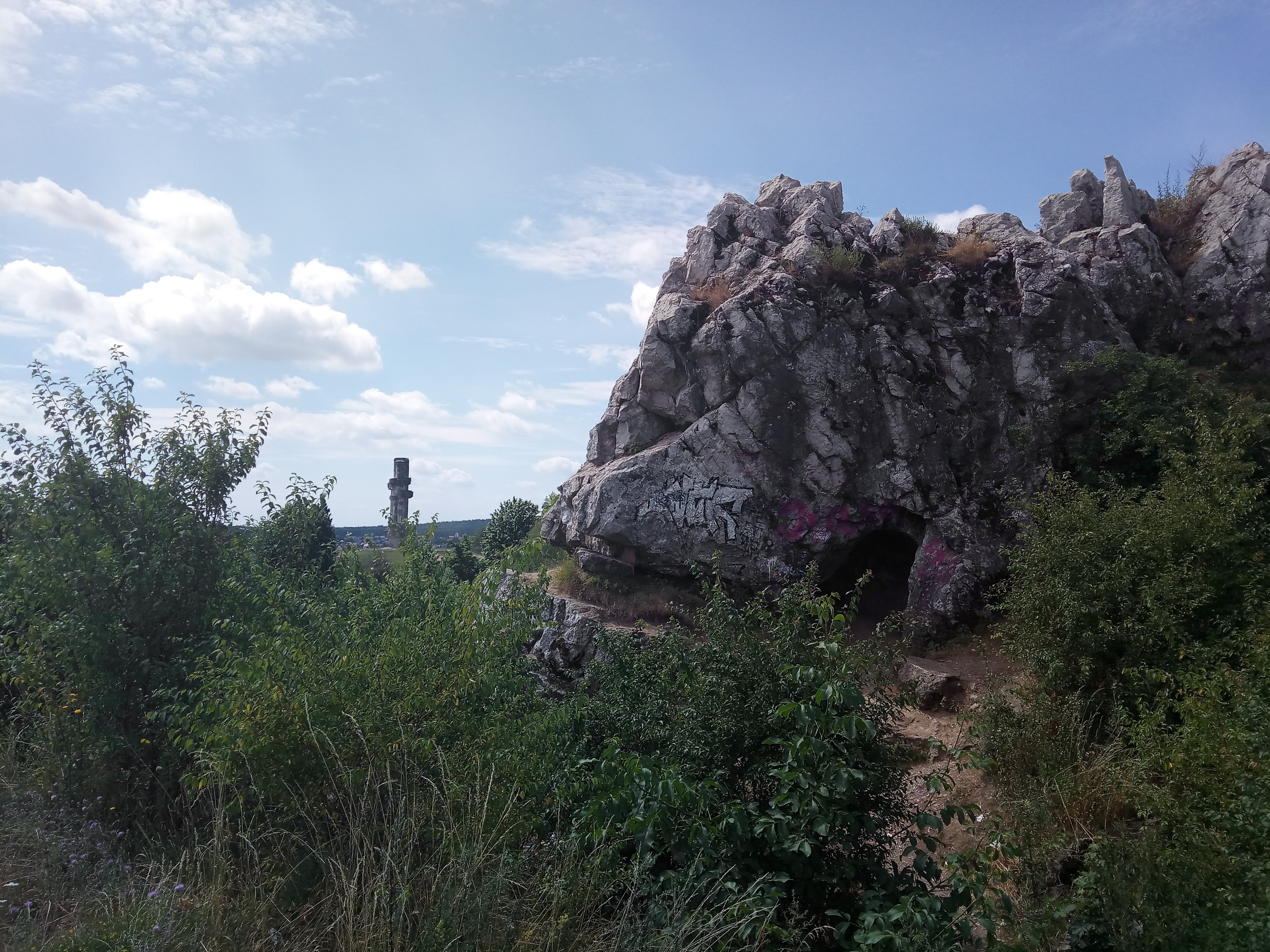


The lower part of Kadzielnia Hill is built of massive and thick bedded limestones (Frasnian, Lower Famennian), which are overlain by thin-bedded limestone-marl- clay series (Famennian). The Neogene karst system occurring within the massive and thick-bedded limestone is partly filled by Quaternary sediments. Therefore, its conduits are accessible as 26 caves with entrances in the faces of the Kadzielnia quarry. The caves are parts of this system not filled by sediments, and are usually several to several ten meters long. The water table lies near the bottom of the quarry (which is suggest- ed by relatively stable water-pool occupying its lowermost part), therefore, the karst conduits that are accessible in the quarry, are now situated in the vadose zone.
http://dx.doi.org/10.7494/geotour.2017.48-49.4
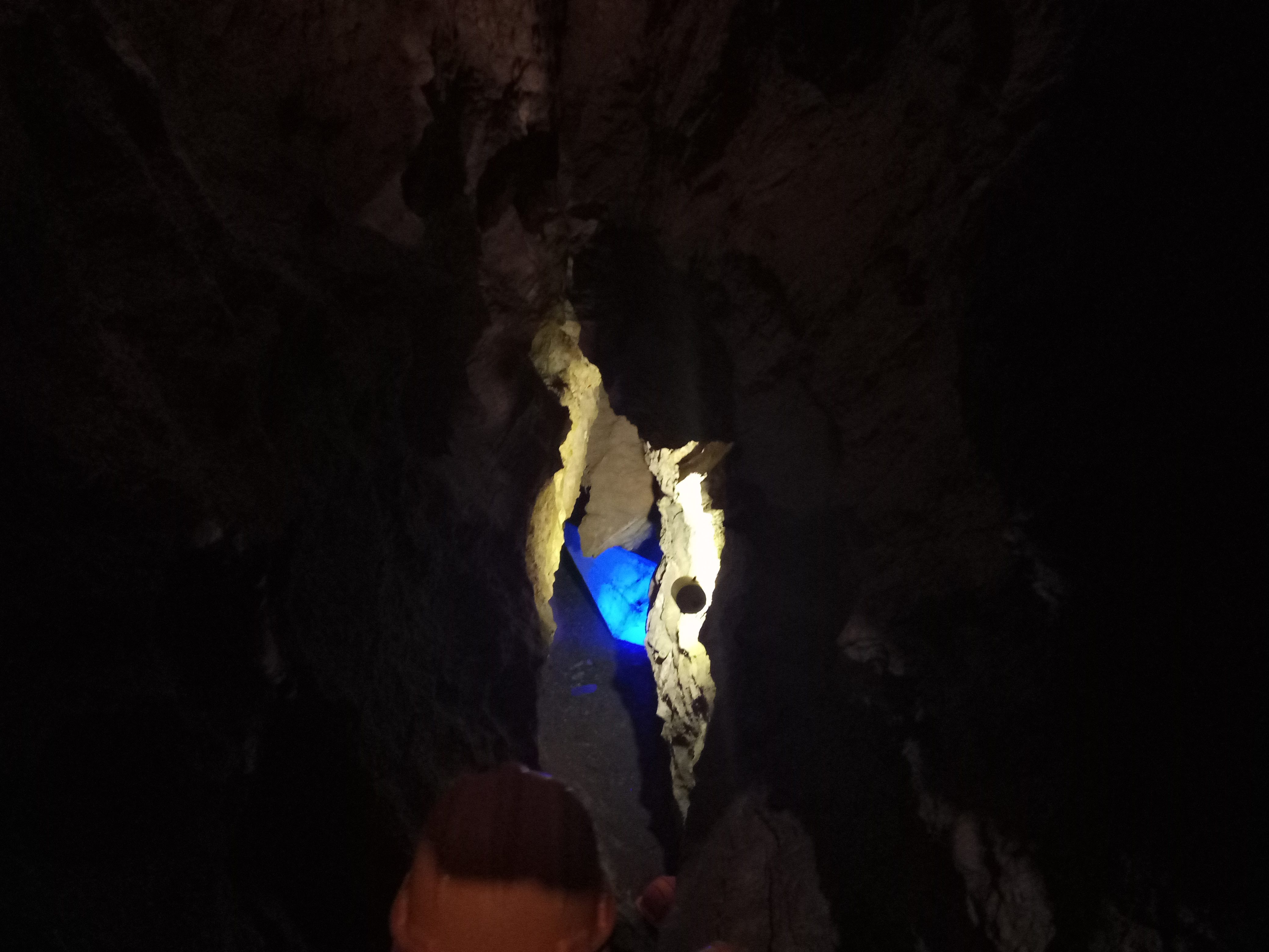
“Kadzielnia is one of the most famous cave site in Poland. According to current data, there are as many as 25 caves and rock shelters on the site of the former quarry! The oldest reference to caves in the Swiętokrzyskie Mountains comes from Kadzielnia, which was included in the “Historical description of the city of Kielce” from 1829: “In the rock of the mountain, a corridor is seen, almost thirteen have been made from nature; the sound of the slightest commotion gave reason to the local people that the money was hidden and, as usual, ghosts of darkness are guarded. “Perhaps this tales and legends owes its name to one of the caves known in the early twentieth century, as Diabla Dziura (Devil’s Hole). In the visible in front of us, the western wall of the Geologists Rocks, holes of four caves are visible. Observing the Geologists “Rock from the vantage point from the Wzgórze Harcerskie (Scouts Hill), we can also see the opening of the Góra Cave. At the foot of the east wall of the quarry there are entrances to three caves currently forming the largest and longest cave system in Kadzielnia: Odkrywców Cave, Prochownia and Szczelina na Kadzielni, with a total length of about 400 m. Part of this system is available through the underground Tourist Route.”
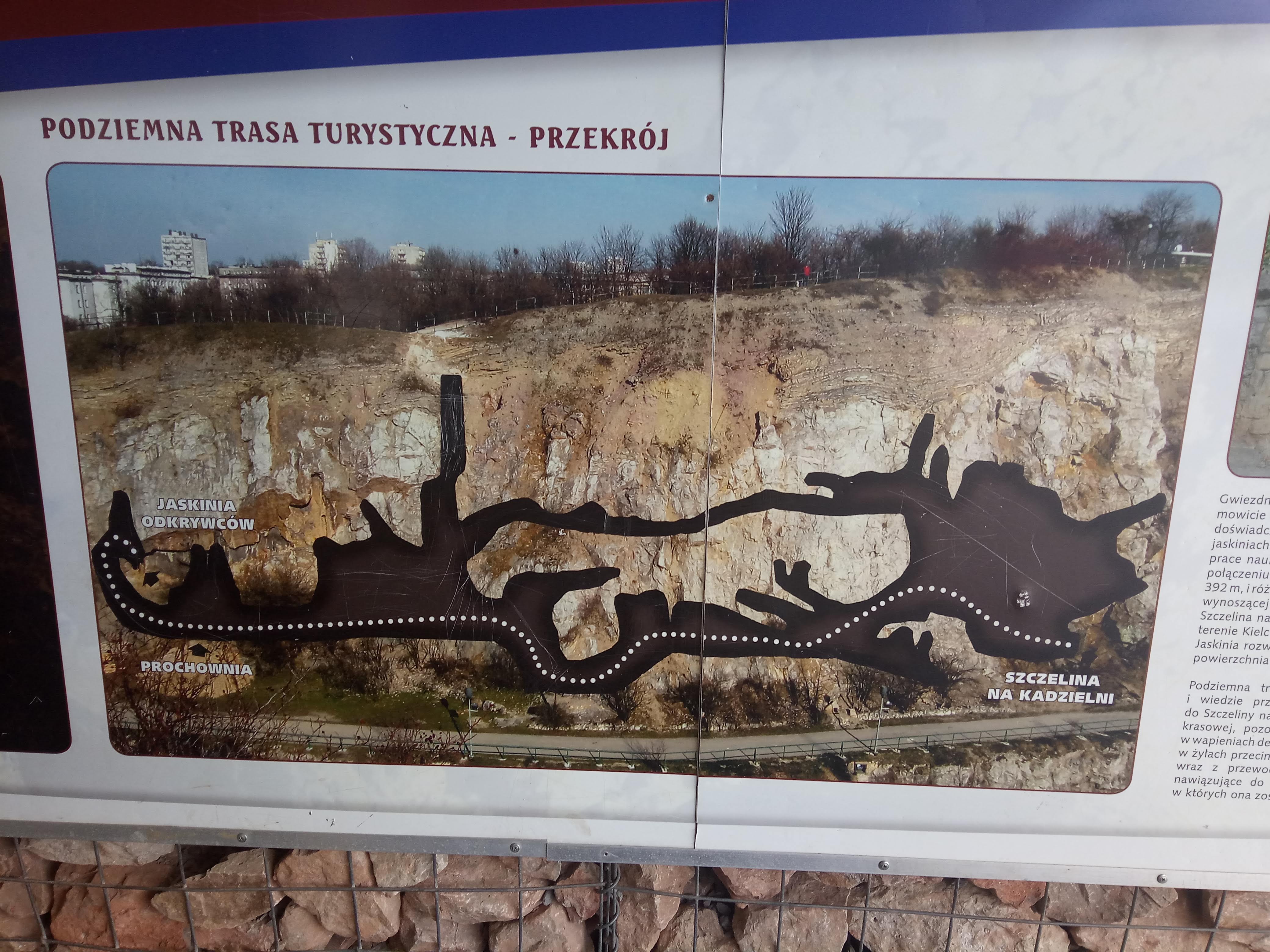
“The underground tourist route of Kadzielnia caves : The underground tourist route running through the interconnected caves of “Odkrywców”, “Prochownia” and “Szczelina” (the Polish for “Explorers”, “Gunpowder Store” and “Crevice”, respectively) is a new highlight on the tourist map of Kielce and the region. Remarkable karst forms and dripstone, interesting minerals and fossils, together with the former alluvia, are but a handful of the caves’ many attractions. For adventure seekers, we have a special feature: a quest for the cave treasure, which is to be located with the help of a map available at the entrance – and the giude. The walk along the Kadzielnia underground route provides a unique opportunity to discover the nature-created world of caves, situated in the city centre.”


The principal elements of these tourist show caves, are sedi-mentary structures and fossils outcropped in the cave walls and presenting the shallow marine depositional environment of Devonian limestone, tectonic structures (fault surface and zone), sediments (tectonic breccia) and connected with them hydrothermal veins filled with calcite and galena, karst morphologies of conduits that indicate the origin and development of the cave, Early Pleistocene and Late Pleistocene-Holocene cave sediments with fossils, as well as calcite speleothems of various shape and age.
http://dx.doi.org/10.7494/geotour.2017.48-49.4

Notes
- The information in italics about the history, geography and paleobiology of the Devonian era rock formation and the cave system is collected/translated from the information/display boards on site.
- DOI: 10.7494/geotour.2017.48-49.4
